Alaska, Mexico and Beyond…

“One Journey Leads to Another”

Archive for the tag “mountains”

Hiking Oaxaca – El Carrizal 2

El Carrizal, located high in the Sierras about 2 1/2 hours from the city of Oaxaca, is one of our favorite hiking/weekend excursion destinations. Some of the local delights from the trip last year can be viewed here.

3244

View of the village of El Carrizal from a trail side mirador (lookout).

A highlight of this visit was learning about three bakeries that produce flat, round and quite tasty loaves, which we savored at every meal! The bread is totally local – growing the trigo (wheat), separating the grain, grinding into flour, mixing, and finally baking.
Click on any photo for a slide show.

2 Photo by Lorna Stone.

The bakery below is owned by two families who bake bread twice a week.

4
The kneading of bread was in this enormous trough made from one tree, smoothed with years of work.

Photo and caption by Lorna Stone. Thanks, Lorna!

_
Tasting and learning!

Corn is another product totally grown and processed locally. Kernals are dried, ground, and made into delicious tortillas, and the husks and stalks are fed to animals. Maybe the husks are even used for tamales! As we were walking along the dirt road toward the mirador, these people waved us over to chat. The corn is typically put on the flat rooftops to dry then removed from the cobs and stored for grinding into the meal or flour for tortillas.
3201

The people of El Carrizal are exceptionally friendly and welcoming. Everyone agreed that these people are what made such a magical weekend! We’ll definitely be back next year.

Hiking Oaxaca: El Carrizal

The angle of the rising sun creates brilliant colors as village life unfolds below our cabañas. El Carrizal is the most pastoral and serene of any mountain village that we have explored so far. The town spreads out in a bowl – it WAS the view, in contrast to other villages that offer views of the vast valleys of Oaxaca.

IMG_2798

click on any photo for a slide show and full captions

Delighted by the lovely, peaceful village, hikers began the descent to the valley far below

Delighted by the lovely, peaceful village, hikers began the descent to the valley far below

IMG_3301

Cascadas spill over rocky ledges and force their way around boulders, forming streams that meander on down through the valleys, undoubtedly gathering into more cascadas along the way!

_DSC4493

A huge variety of plants grow in the Sierras – from this enormous maguey to a tiny cactus. Photographer Impett estimated the quiote (flower stalk) to be 40 feet tall!


Taking advantage of the cold mountain streams, people in many villages have built small trucha (trout) farms and restaurants. This man is catching our dinner – talk about fresh!   Photo by Rick Impett.

Whether hiking, biking, or relaxing with a good book, the friendly people and beautiful vistas of El Carrizal make it a wonderful place to visit!

BUT BEWARE – YOU NEVER KNOW WHO IS WATCHING…

_DSC4366

Photo by Rick Impett


Hiking Oaxaca: Benito Juárez

Perched at 10,000 ft. in the Sierras, overlooking the Tlacolula Valley, the village of Benito Juarez is a wonderful destination for hiking through cool pine forests, mountain biking, horseback riding, birdwatching, or just hanging out and enjoying the fresh mountain air.

Benito Juarez (1 of 2)

Looking down on Benito Juárez from the mirador. Rick Impett

Click on any photo to enlarge it. Photos contributed by other hikers have the photographer’s name in the caption.
A group of 20 hikers and birders, through the organization Hoofing It In Oaxaca, spent a fun weekend participating in a variety of outdoor activities.


IMG_2589

What goes up must come down and vice versa – the mirador is a steep hike UP, which creates a huff and puff situation at this altitude, but it’s so easy going back down (though sometimes hard on the knees). Hiking to the cascada was the opposite – DOWN to the bottom of a ravine followed by the steep climb up. Either way we passed through beautiful farmland where friendly local people waved to us from their fields.

Benito Juarez (2 of 2)

Giant maguey plants make perfect fences! – Rick Impett


IMG_2580

Hikers are dwarfed by one of the biggest maguey plants I have ever seen! A loaded crab apple tree is growing behind it.

Our group included a family with two kids excited to try the zip line that was built on the mirador.

Some zippers express unbounded joy!
IMG_2457

Others just hang out and marvel at the world far below.
IMG_2478

Ecotourism facilities are developed as a way to bring income and employment to mountain communities. People in the community take turns volunteering for a year at a time to support their villages. So welcoming and kind, they are really what make these excursions special. These ladies prepared tasty food that showcased local mushrooms, the hot chocolate is exceptional (no powdered mix here!) and of course there is mezcal.
Each cabaña has a fireplace, and in the evening a young man brings wood and a magic stick and builds a cozy fire. In the morning (or whenever you want) he will light a water heater so you can take a hot shower. Most of the villagers do not have these conveniences in their own homes. comment by hiker Bernie Goldray.
DSCN4600
After a day of hiking, zipping, and birdwatching, friends gather to relax before strolling up (yes, it was UP) to the comedor for a yummy dinner and a boot of mezcal.

Taking a well deserved siesta after a long day…our driver, guide who entertains us with stories and information, and friend extraordinaire, Nicolas Garcia.
DSCN4603

Benito Juárez was one of the highlights of my trip. I will remember the views, the early morning fog rolling up the hills, the goat herder who asked to give me a hug because I was ‘muy fuerte’, watercress cooked on the comal for breakfast, the astonishing view from the mirador, the easy comraderie of our group, how elegant I was (think Audrey Hepburn!) with a hat and shirt wrapped around my head as I tried to sleep in the cold. Comments by Amber Karr.

Cee’s Which Way Challenge #12

SOMETIMES ACROSS IS THE ONLY WAY

20141207-IMG_9372

MIRADOR ABOVE THE VILLAGE OF BENITO JUAREZ, OAXACA

20140201-IMG_2024 (2)

20140201-IMG_1977
SANTIAGO YOSUNDUA, NEAR THE VILLAGE OF SAN MIGUEL DE GRANDE IN WESTERN OAXACA

click here to enjoy more Which Way photos:
http://ceenphotography.com/2015/03/25/cees-which-way-photo-challenge-2015-week-12/

Cee’s Which Way Challenge

Dusty dirt roads (and some paved ones too!) hug the contours of the Sierra Norte, urging the traveler to climb one more mountain to see what’s on the other side. Or maybe said traveler is just hoping the destination is around the next bend so he or she can exit the mode of transportation, especially if it is the back of a swaying van!

Via the road at bottom center we bounced our way to the village of Lachatao, Oaxaca, perched at approximately 7000′ altitude. Viewed from a ridge high above Lachatao, the landscape offered roads as far as the eye could see. We could only wonder where they led.

20150308-IMG_2854


Stunning scenery can often be viewed from the back of a pick-up truck taxi!
20150217-IMG_1832

To enjoy other Which Way photos, click

Travel Theme: Details

20150207-IMG_1489

Natural Details

20150207-IMG_1535

To view more posts on Details click https://blu178.mail.live.com/?tid=cmbR2F3z6u5BGVa9idZ1x5NA2&fid=flinbox

Weekly Photo Challenge: Depth

20150126-IMG_1153

Capulalpam, Oaxaca, Mexico

20150127-IMG_1320

In response to The Daily Post’s weekly photo challenge: “Depth.”

The World Has So Much to Offer…

And in this corner of the world is Oaxaca!

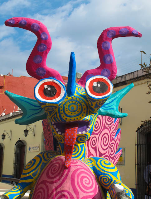
Life in Oaxaca is rich withHumorous art

HUMOR

20141125-IMG_8879

THE PAST

20141115-IMG_8457
THE FUTURE

20141128-IMG_8973

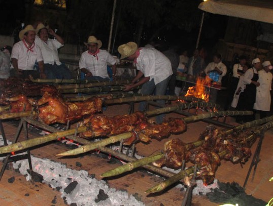
 FOOD

20150105-IMG_0439

ART

20141025-IMG_7719

NATURE

20150103-IMG_0278

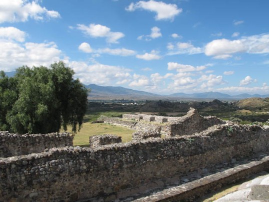
WONDERFUL HIDDEN PLACES

I hope  readers will learn from and smile at my photographic stories!

Ruins of a Spanish Mine

Spread along the Rio Papaloapam, high in the Sierra Norte north of the city of Oaxaca, are the ruins of Spanish haciendas that were built and inhabited during the years of Spanish exploitation of the mineral riches of the area.

According to historical records, Cortés learned of the possible existence of gold and silver in the Sierras and immediately sent scouts in search of the minerals. They returned with the news that the mountains were indeed rich with gold and silver ore, and Cortés, ever the opportunist, claimed the entire Central Valley of Oaxaca for himself (year 1521). The Spaniards built the infrastructure needed for mining operations and constructed aqueducts, large haciendas, stone bridges, and a church. These remains are located deep in a lush valley near the villages of San Miguel Amatlán and Lachatao.

Hacienda Wall

Hacienda Wall

Click on any photo to enlarge it   

The Friday hikers explored El Socorro, the first section of the Spanish ruins.

A sinuous highway (the highway signs said so!) led us through seemingly endless mountains that offered spectacular vistas. Local people navigate narrow gravel roads that zig-zag up the mountainsides to their villages.

Winding River, Winding Road

Winding River, Winding Road

After climbing to the mountaintop to pick up our guides in the tiny village of Amatlán, our excellent bus driver maneuvered to the valley floor on a dirt road that was clearly not designed for a school bus! He received a loud cheer and applause when we reached the fork where the hikers got off and started down the trail, while he continued on to a wide spot where he was faced with the daunting task of turning the bus around!

Our guides hopped off the bus and cleared rocks from the “road.”


Ruins of the Hacienda

Ruins of the Hacienda

Trout were visible lazing in the shadows of pools in the river, which  runs with clean, clear water.

Trout were visible lazing in the shadows of pools in the clean, clear waters of the Rio Papaloapam.

The pink blossoms decorated fat cactus in perfect circles.

Perfect circles of pink blossoms crown these fat cactus

Epiphytes grow anywhere and everywhere they can find a resting place. Some cactus favor the tops of old stone walls, while other prefer to just hang around.

Mountainside church

At the end of a long day of busing, hiking, and exploring…what could be better than relaxing and spending the night in a cabaña with a view!

Cabin with a View

For information on ecotourism in The Sierra Norte, and how YOU TOO could hike in these magnificent mountains and end your day in one of many charming cabañas:

http://sierranorte.org.mx/

http://www.oaxaca.travel/

Several of the photos in this blog were taken by my husband, David, who has become a hiker and photographer too!

WOWs! in Western Oaxaca

Tucked away in the mountains of Western Oaxaca, home of the Mixteca, is the hidden gem of Cascada La Esmeralda. The Rio La Esmeralda tumbles over a high ledge and ricochets its way over rocky outcrops as it plummets more than 100 meters (328 ft.)to the valley below.

I recently spent the weekend with friends in the region of San Miguel el Grande, and the four of us and the dog packed into the front of their small Toyota pick-up and headed out to enjoy the day in this spectacular area near the town of Yosondúa.

Cascade

Imagine Cascada Esmeralda thundering down this rockface during the rainy season! Since this is the middle of the dry season, and it has rained little for several months, the volume of water rushing over the edge has greatly diminished.

Click on any photo to enlarge it.

Crossing the footbridge, you will be awed with magnificent views of the cascade above, the valley below, and the mountains beyond.

Footbridge

Not for the faint of heart!

One zip line has been built below the bridge, and from our perfect vantage point on the bridge we watched this man listen to instructions and ZIP! We also watched another man who donned his helmet, asked many questions, and then chickened out! Maybe next year.

Workers are completing the platforms for another zip line that has been installed high above the bridge. Maybe the second man decided to wait for the REAL challenge!

Convenient stone walkways are being constructed through the forest although many paths crisscross the hillsides, and visitors are free to walk anywhere they want. There are no signs telling people what to do or not to do. So refreshing.

During your descent you will pass two lovely eco-cabañas where you could spend a relaxing night after a day of hiking.

Back in the village of Victoria, where my friends live, the “Fiesta de la Virgen de la Candelaria y el Señor de los Milagros” was in full swing. We feasted on “fiesta food” (tacos, ice cream, fried bananas, cups of fresh fruit…) laughed as we watched the Luche Libre (Mexican variety of professional wrestling) and hung out to wait for the second WOW of the day – the castillos.  It’s difficult to know the true height of these towers of fireworks, but our estimation in relation to nearby buildings and trees is that they must be at least 75 feet tall – maybe more. A castillo has to be one of the most wonderful of all things Mexican.

Stunning fireworks awed the crowd between the lighting of each section, and of course all was accompanied by very loud music! I didn’t even try to photograph anymore; I just enjoyed the show.

Castillo

Looming above the church and the trees, three castillos are waiting to dazzle the crowd.

Castillo

Bless Your Pueblo – My Mother

WOW, What a day!

If you would like to see more castillo photos, or to learn how they are built, click https://alaskamexicoandbeyond.wordpress.com/2013/01/30/are-mexican-fireworks-made-in-china/ or https://alaskamexicoandbeyond.wordpress.com/2013/01/21/life-is-a-blast/

Post Navigation