Perched at 10,000 ft. in the Sierras, overlooking the Tlacolula Valley, the village of Benito Juarez is a wonderful destination for hiking through cool pine forests, mountain biking, horseback riding, birdwatching, or just hanging out and enjoying the fresh mountain air.

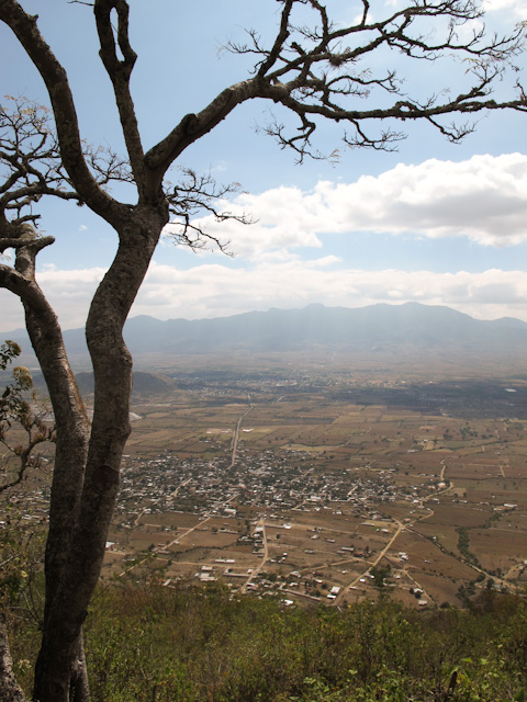
Looking down on Benito Juárez from the mirador. Rick Impett
Click on any photo to enlarge it. Photos contributed by other hikers have the photographer’s name in the caption.
A group of 20 hikers and birders, through the organization Hoofing It In Oaxaca, spent a fun weekend participating in a variety of outdoor activities.
")
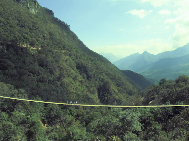
Lots to do – zip line, hanging bridge, hiking to BIG rock or waterfalls – Rick Impett
")
Welcome to Benito Juárez – Rick Impett

Local guides lead hikers through pine forests, teaching about medicinal uses of plants and local history – Ann Crew

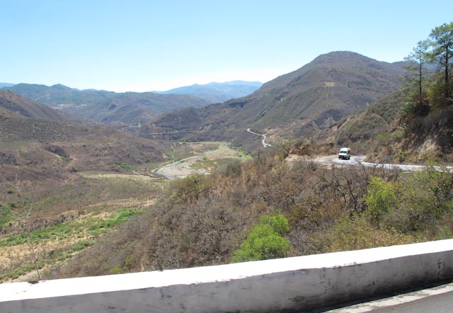
What goes up must come down and vice versa – the mirador is a steep hike UP, which creates a huff and puff situation at this altitude, but it’s so easy going back down (though sometimes hard on the knees). Hiking to the cascada was the opposite – DOWN to the bottom of a ravine followed by the steep climb up. Either way we passed through beautiful farmland where friendly local people waved to us from their fields.

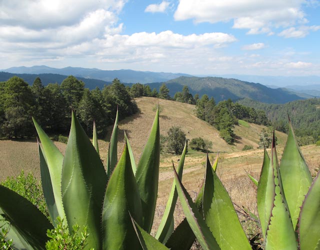
Giant maguey plants make perfect fences! – Rick Impett

Showing off for the ladies.
")
photo by Rick Impett
")
Beginning to prepare the field for the next planting. – Rick Impett

Further uphill she pulls out the last of the dry cornstalks.

Bundled and loaded, the cornstalks will be used for multiple purposes.

Guide showing us how people carve out sections of certain pines to use as fire starters. We call these magic sticks because you can light one little stick with a match and it will start a properly laid pile of wood.

Sap in the heartwood that creates the magic sticks. Boy Scouts would have loved this!

Towering pines, some 100 feet tall and straight as an arrow, fill the Sierra mountainsides.

Hikers are dwarfed by one of the biggest maguey plants I have ever seen! A loaded crab apple tree is growing behind it.

Many varieties of mushrooms pop up in the pine forests, but most appear much later in the year, so we were lucky to see these.

Flowers of a type of aloe – I think they are called Red Hot Pokers in English

Lupine grow in the spruce forests of Alaska, in mountain areas down the west coast, and here they are again at high altitudes of Mexico!
Our group included a family with two kids excited to try the zip line that was built on the mirador.

Getting ready to zip!

Last instructions…then let go!

Reaching out at the end of the line.

This is how zippers are retrieved when the line incline is not steep enough for their light weights to reach the end.
Some zippers express unbounded joy!

Others just hang out and marvel at the world far below.

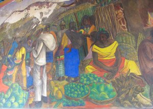
Ecotourism facilities are developed as a way to bring income and employment to mountain communities. People in the community take turns volunteering for a year at a time to support their villages. So welcoming and kind, they are really what make these excursions special. These ladies prepared tasty food that showcased local mushrooms, the hot chocolate is exceptional (no powdered mix here!) and of course there is mezcal.
Each cabaña has a fireplace, and in the evening a young man brings wood and a magic stick and builds a cozy fire. In the morning (or whenever you want) he will light a water heater so you can take a hot shower. Most of the villagers do not have these conveniences in their own homes. comment by hiker Bernie Goldray.

After a day of hiking, zipping, and birdwatching, friends gather to relax before strolling up (yes, it was UP) to the comedor for a yummy dinner and a boot of mezcal.

Photo by Jo-Anne Vandierendonck
Taking a well deserved siesta after a long day…our driver, guide who entertains us with stories and information, and friend extraordinaire, Nicolas Garcia.

Benito Juárez was one of the highlights of my trip. I will remember the views, the early morning fog rolling up the hills, the goat herder who asked to give me a hug because I was ‘muy fuerte’, watercress cooked on the comal for breakfast, the astonishing view from the mirador, the easy comraderie of our group, how elegant I was (think Audrey Hepburn!) with a hat and shirt wrapped around my head as I tried to sleep in the cold. Comments by Amber Karr.

 Photo by Lorna Stone.


")